Buslens
Transit mapping tool · Visualise bus travel reach across the UK
rupertlinacre.com
About
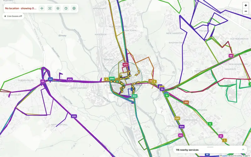
Buslens is a web-based mapping tool that allows users to visualize how far they can travel by bus from a specific location within a set timeframe. It is designed for commuters and travelers in the UK looking to understand public transport connectivity.
- Type
- Transit mapping tool
- Category
- Productivity
- Pricing
- Free
- For
- UK commuters and public transport users
- Launched
- 2026-08-26
Description written by AI Tool Garage from the maker's launch post. Details and pricing can change: check rupertlinacre.com before you rely on them.
More fresh productivity tools